
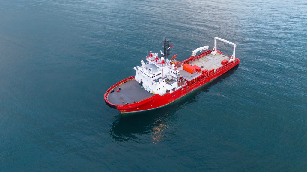
Offshore Career Path Explained: Exploring Careers in Hydrographic Survey
Hydrographic surveying plays a vital role in helping us understand and navigate the underwater world. As of 2026, just 28.7% of the global seafloor has been mapped to modern standards, meaning there is still a huge amount of the ocean left to explore and understand.
This is where hydrographic surveyors come in. From collecting detailed measurements of the seabed to processing and analysing the data, they use specialist technology to build a clearer picture of what lies beneath the surface. The role combines technical expertise, attention to detail, problem-solving and teamwork, often in challenging offshore environments.
For those interested in state-of-the-art technology, the marine environment and contributing to our understanding of the world’s oceans, hydrographic surveying could be an exciting career path for you to explore.
Read on to find out what hydrographic surveyors do, the skills and qualifications involved, and where a career in hydrographic surveying can take you.
What Does a Hydrographic Surveyor Do?
Hydrographic surveyors (also known as hydrographers, or droggies if you’re in the Navy) use specialist equipment to map and measure the underwater environment, collecting data on water depths, tides, currents, seabed features and other characteristics of the marine environment. They process and analyse this data to create accurate hydrographic models and survey deliverables for a range of applications.
Modern hydrographic surveyors use technologies such as multibeam and single-beam echosounders, GNSS, inertial navigation systems and, in some applications, LiDAR.
Multibeam echosounders use multiple acoustic beams to measure water depth and map the seabed across a wide area, while single-beam echosounders measure depth directly beneath the vessel along individual survey lines. GNSS provides precise positioning, while inertial navigation systems help track the vessel’s movement and orientation to ensure survey data is accurately located. In some applications, LiDAR is also used which sends laser pulses to measure shallow water and coastal areas.
What Is Hydrographic Surveying Used For?
Hydrographic surveying provides accurate and detailed data about underwater environments, supporting a wide range of marine industries and projects.
The data collected can be used for:
- Predicting and monitoring the environmental impact of marine developments
- Dredging projects
- Locating offshore resources such as oil, gas and aggregates
- Planning and positioning offshore wind farms, oil and gas infrastructure, and subsea cables
- Planning dock and port installations
- Monitoring seabed changes and erosion
- Supporting safe navigation for commercial shipping
Work Patterns
Hydrographic surveyors may work offshore, onshore, or a mix of both, depending on the project and their role. Offshore work typically involves shift work, often 12-hour shifts, with rotations such as 6 weeks on / 6 weeks off. However, exact rotation length varies depending on the project and client. Onshore roles generally follow standard working hours (9am-5pm), although more senior members of staff may occasionally be required to complete weekend duty, which involves being on call to handle any offshore problems.
Who Hydrographic Surveyors Work With
Hydrographic surveyors are part of a dedicated survey team, but they also work closely with other teams involved in the wider offshore project.
Their Survey Team
Depending on the company and project, a hydrographic survey team may include:
Party Chief / Survey Party Chief – leads the survey team on a day-to-day basis, coordinates tasks, liaises with the client and oversees the safe and effective delivery of survey operations.
Chief Surveyor – provides senior technical oversight of the survey operation, supporting the team with technical decisions, data quality and overall survey requirements.
Online (Field) Surveyors – operate the survey equipment and acquire and monitor data in real time during offshore operations.
Offline (Processing) Surveyors – process and quality-check the data collected offshore and prepare charts, models and other survey deliverables.
The exact structure and number of survey personnel will vary depending on the vessel, project and scope of work.
Who They Work Alongside
Hydrographic surveyors also work alongside other personnel involved in the wider project, including:
Project Managers – oversee the wider project, including scheduling, budgets, client communication and overall delivery.
Client Representatives – may be based offshore or communicate regularly with the survey team to review progress, data and project requirements.
Vessel Crew – operate and safely position the vessel supporting the survey operation.
ROV Teams – work alongside surveyors on projects involving subsea inspection, cable installation, pipeline work and other underwater operations.
Dive Teams – may be involved on projects requiring divers, particularly for inspection or work in shallower water.
Offshore crews are often multinational and multidisciplinary, so strong communication skills (particularly in English) and the ability to work effectively with people from different technical backgrounds are important qualities for a hydrographic surveyor
Common Routes into the industry
Entry into hydrographic surveying can take several paths, depending on your career goals and educational background.
However, a bachelor’s degree in a relevant subject such as:
- Geomatics
- Geographic Information Systems (GIS)
- Geology
- Marine Science
- Ocean exploration
- Geography
Provides the strongest foundation for a career in hydrographic surveying.
A postgraduate qualification in hydrographic surveying, hydrography or geomatics is also particularly useful for graduates coming from a related but non-specialist degree.
When choosing a course, it is worth checking its industry links, practical training and relevant professional or international recognition, including alignment with the International Hydrographic Organization (IHO) S-5 standards.
Skills that matter most
Success in hydrographic surveying requires a blend of technical expertise, physical capabilities, and interpersonal skills. Understanding which skills are most important can help you assess whether this career aligns with your strengths and interests.
- Technical Proficiency: Proficiency with advanced surveying equipment such as multibeam sonars, GPS systems, and underwater cameras is essential.
- Data Processing and Analysis: Ability to process and analyse large datasets generated by modern surveys.
- The ability to maintain concentration: carelessness or a lapse in concentration may have drastic consequences in terms of the overall quality or efficiency of a survey
- Good teamworking skills: the ability to work closely and get on with others in pressurised situations is key
- Problem-solving: Logical thinking paired with a practical, hands-on approach to working through issues as they come up
Career Progression
Although individual pathways differ, a common progression looks like the following:
Trainee Surveyor → Hydrographic Surveyor → Senior Hydrographic Surveyor → Party Chief
Entry typically starts at graduate level, joining one of the larger operators as a trainee hydrographic surveyor. After completing structured training and gaining offshore experience, surveyors progress to full surveyor roles, then senior positions, and eventually management roles such as Party Chief.
Many experienced hydrographers go on to work freelance. Once you’ve built up solid offshore experience, freelancing through a company like Precise Consultants becomes a realistic next step.
Salary Expectations
Compensation varies significantly by region, employer, vessel type, and rotation pattern. As a broad indication, hydrographic surveyors are generally well-compensated, and experienced individuals, particularly those working offshore or on a freelance/day-rate basis, can command premium rates in certain markets.
Rather than focusing on headline figures, candidates should evaluate:
- Day rate versus salaried structure
- Rotation pattern
- Travel and accommodation arrangements
- Training and career development support
- Long-term progression opportunities
Conclusion:
Hydrographic surveying offers a wide spanning, varied career with the chance to work across diverse projects using cutting edge technology, from multibeam sonar and LiDAR to GPS and inertial navigation systems, all used to create detailed 3D maps of underwater terrain. As this technology continues to evolve, it opens up ongoing opportunities for career growth and innovation, making hydrographic surveying an exciting and rewarding path for anyone interested in maritime safety, environmental protection or technological advancement.
The clearest way in is a degree in a related discipline such as geomatics, GIS, geology, marine science, ocean exploration and surveying or geography, followed by a trainee role with an established operator to build key technical experience. From there, progressing through surveyor, senior surveyor and eventually party chief opens the door to freelance and contract work, which forms the backbone of project-based demand across the sector. At Precise Consultants we specialise in placing experienced freelance survey professionals with clients rather than recruiting for permanent roles, so once you’ve built that trainee foundation and gained some years behind you, we’re a strong next step for finding freelance opportunities.
Related News
“I’ve Been Made Redundant from an Offshore Staff Role – What Are My Options?”
Being made redundant from a permanent offshore role is disruptive and unsettling, especially when it’s a career you’ve built over…

How Starlink Has Changed the Offshore Landscape
For decades, going offshore meant accepting a degree of digital absence. In the days before reliable offshore connectivity, workers would…